Winter Wonderland: 10 Must-Explore Vermont State Park Hikes
.jpg) |
The Japanese Garden at Taconic Mountains Ramble State Park in Winter - Rebecca Roy |
What Can You Expect to See on an Off-Season Hike?
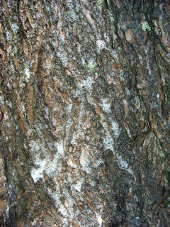
From “Stick Season” to “Mud Season”, Vermont State Parks have so much to offer. Animal habitats and signs become more noticeable - be on the lookout for squirrel caches, porcupine dens, and pileated woodpecker holes. Hillsides, slopes, and mountains can appear differently after the leaves have fallen. Have you been wanting to spruce up your tree ID? Winter is a great time to focus on bark characteristics and branch patterns! This is your invitation to slow down, use all your senses, and recognize the seasonal changes happening around you.
Next time you find yourself in a lean-to loop, standing next to an off-duty picnic table, or roaming down the leaf-covered roads, take a moment to recognize the many differences between seasons. Off-season brings a striking contrast to summer days. The same beach that hosted swimmers and sandcastles in August is, by January, silent, frozen, and peaceful. The natural world changes drastically between seasons, and it’s even easier to notice all the hard work it takes to get the treasured camping spots ready for visitors each spring. Shout out to seasonal park staff, the real MVPs!
How Can You Prepare for Your Hike?
- Match the trail to your ability. Check TrailFinder.info to search for hikes by difficulty, length, location, and trail status. Trail managers across the state post trail updates and alerts on TrailFinder which makes it a great resource for up-to-date trail conditions.
- Be prepared in case of emergency, dress for the weather, and appropriate footwear — looking at you, Croc lovers! Sharing your planned route and approximate return time with a friend or family member is wise as well. Looking for more tips and tricks? Check out the Green Mountain Club’s Winter Hiking page.
- Hunting is permitted on most state lands, including parks. Since hunting seasons run from September 1st through mid-December, wearing blaze orange and making yourself heard while recreating are both good practices. Check out the full list of Vermont hunting season dates.
- Check the Off Season Parking & Access for Vermont State Parks. Access is mostly by foot. Most gates are locked for the season.
Ready to plan your hike?
Check out our top picks for low to mid-elevation hikes from parks staff, foresters, and recreation specialists around the state.
Northeast
 |
| Mrs. Goodell and her daughter pose in a black and white photo in front of their homestead on Ricker Mountain in the 1890's. Photo: VSP Archives |
3.9 miles, Moderate
Little River State Park Trail Map
This is part of the self-guided Little River History Hike which meanders through the once bustling town of Ricker Mountain.
The town was completely abandoned by the time the CCC started building the Waterbury Dam in 1934. The trails are well marked, meandering through many old homesteads & feature many interpretive panels along the way. Many artifacts, foundations, a cemetery, and even a building still stand today.
Roads leading to the Little River and the Dalley Loop trailhead are subject to seasonal closure from mid-October through mid-May. Visitors are welcome to walk into the park past the closed gate, which would add another 2 miles onto the hikes.
Feeling like something a little more low-key? No problem! Just outside the gate to Little River lies the trailhead to the…
Camp Smith Loop Trail just outside Little River State Park
1.0 mile, ADA Accessible
Little River State Park and Cottonbrook on TrailFinder
See the remains of a 1930s-era work camp that housed the 3,000 CCC workers who built the Waterbury Dam 80 years ago! Interpretive panels share the history of many sites along the pathway. This flat, wide gravel trail is great for young children who are just getting their hiking feet!
Kettle Pond Loop in Groton State Forest
3 miles, Easy
Map of Groton State Forest Trails
This trail passes by many remote campsites, starting and ending at the main parking lot. The Lean-tos around this beautiful pond were built over many years, some by the Civilian Conservation Corp, and some later on.
Coldwater Brook Trail in Groton State Forest 
A man and with bundled up baby in tow
takes a break against a white birch tree
along snowy Coldwater Brook Trail.
Photo: Kaley Grenier

takes a break against a white birch tree
along snowy Coldwater Brook Trail.
Photo: Kaley Grenier
1.9 Miles, Moderate
Map of Groton State Forest Trails
Diverse woods, this trail starts at the Groton Nature Center lot, with the option to take this trail to the summit of Big Deer Mountain if the mood strikes you! Looking to extend your hike? Big Deer Mountain via Coldwater Brook Trail is 4.9 miles and rated Moderate.
Northwest
Round Pond State Park, South Hero
1.1 miles, Easy
Round Pond State Park Trail Map
Forest, Meadow, and Shoreline habitats can all be found in this small 15-acre undeveloped State Park. Round Pond is an undeveloped state park maintained by Vermont State Parks, Lake Champlain Land Trust & South Hero Land Trust.
Muhley and Island View Loop Trail in Niquette Bay State Park
2.9 miles, Easy
Niquette Bay State Park Trail Map
Niquette Bay is a great place for running, birding, and ephemeral flowers in the spring. There are options to detour off this loop to visit the shoreline of Lake Champlain.
 |
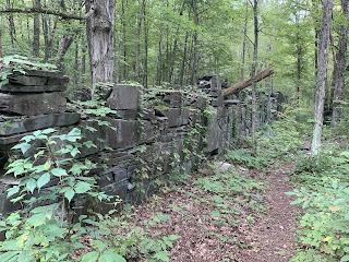
| The trail follows beside an old Slate Wall on the Slate HistoryTrail within Bomoseen State Park Photo: Molly Austin |
Slate History Trail at Bomoseen State Park
0.75 miles, Easy
The Slate History Trail Interpretive Guide and Map
Explore this unique area of Vermont and the abandoned Slate Village of West Castleton. At one time, the town had 43 houses, a store, a school, three barns, two sawmills and several quarries!
Loop at Taconic Mountains Ramble State Park, Hubbardton
2.4 Miles, Easy
Taconic Mountains Ramble State Park - Eastern Trails Map
Taconic Mountains Ramble State Park - Western Trails Map
Many trails ramble through this one-of-a-kind State Park. The former owner created the Japanese Garden, which is nestled amongst a small pond and massive boulders, and the views aren’t too shabby either! The Japanese Garden is just 0.2 miles from the parking lot, but you could easily spend an entire afternoon exploring here. Combine the Japanese Garden, South Meadow, and Falls out-and-back trails for a 2.4-mile easy hike. Some trails do have rock scrambles & steep inclines, so plan accordingly.
 |
| Trails in the snow pass by a building at Lowell Lake State Park Photo: Pam Jones |
Lowell Lake Trail at Lowell Lake State Park
3.5 miles, Easy to Moderate
Lowell Lake State Park Map
Lowell Lake TrailFinder page
A combination of footpaths and snowmobile trails, this loop passes a Revolutionary War-era cemetery, a bog and wetlands, as well as many picturesque views of the lake. A true Winter Wonderland!
Mount Olga Trail to Fire Tower, Molly Stark State Park
1.7 miles, Moderate
Molly Stark State Park Recreational Trails Guide
The historic fire tower at Mount Olga was moved from Townshend State Park in 1955. Evidence of the land’s agricultural past is visible at the beginning of the trail. The tower rises above the beautiful hardwood forests and reveals an expansive 360° view from atop the tower.
Looking for hikes all year round?
Check out the Vermont State Parks Hiking page for trail recommendations by region, hiking with kids, and more.
Did you find something interesting on your hike? Send us an email at parks@vermont.gov or tag us on social media at VTStateParks on Facebook, Instagram, and X.

.jpg)
Comments
Post a Comment
Feel free to let us know what you think.